
Click here for current conditions, live radar, and any closings or delays
INDIANAPOLIS, Ind.– A Winter Weather Advisory has been issued for central Indiana through 7 p.m. Thursday.
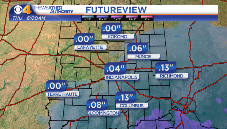
A strong area of low pressure will bring a rain/freezing rain mix to the southern half of the state overnight. Up to a tenth of an inch of ice is likely by 6 a.m. The wintry mix will change to snow during the morning rush hour and 1-2″ will accumulate over most of central Indiana during the day. Up to 3″ of snow is possible in a few spots over the westernmost part of the state.
Dry weather will return on Friday and temperatures will warm into the 40s, so any ice or snow will melt.
Another cold front will move across the state late Saturday and a rain/snow mix will be likely. Behind the cold front we’ll have a sunny, cold Sunday with highs in the 30s.
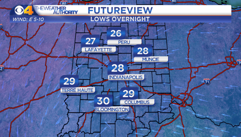
Low temperatures will cool into the 20s overnight.
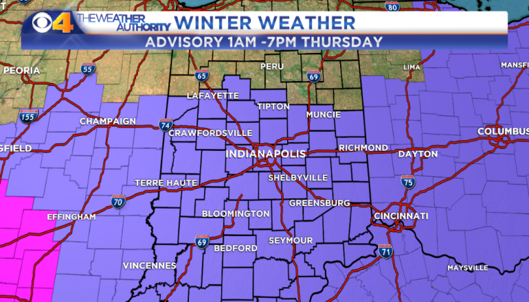
A Winter Weather Advisory is in effect for Thursday.
Ice will accumulate south of I-70.
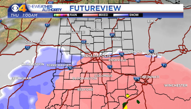
Freezing rain will develop over the southern part of the state by 1am.
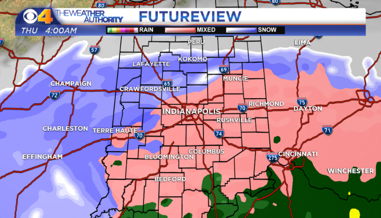
Freezing rain will continue overnight.
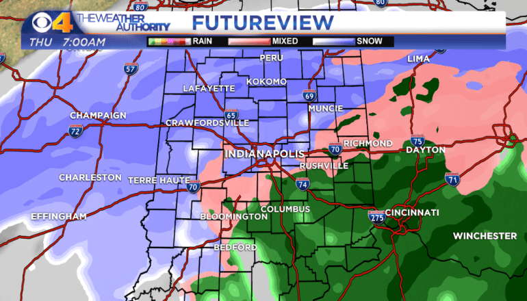
Our wintry mix will change to snow during the morning rush hour.
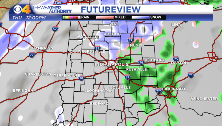
Snow tapers off by lunchtime.
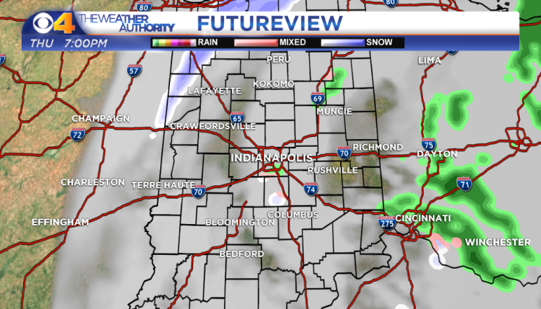
Snow will end by evening.
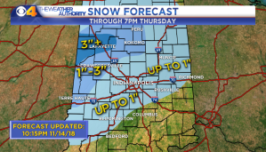
1-2″ of snow is likely Thursday.
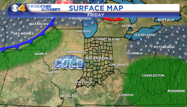
Sunshine will return for Friday.
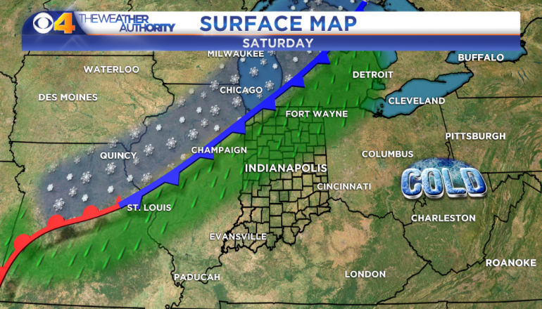
Another rain/snow mix is likely Saturday night.
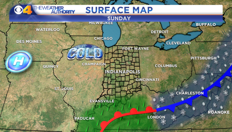
We’ll have a sunny, cold Sunday.


