
A little hazy Friday morning but no other concerns from the weather department! Thursday was pleasant with a seasonable high of 43 and Friday will be even a few degrees better as we eventually climb into the upper 40s. With no wet weather, that’ll be quite pleasant.
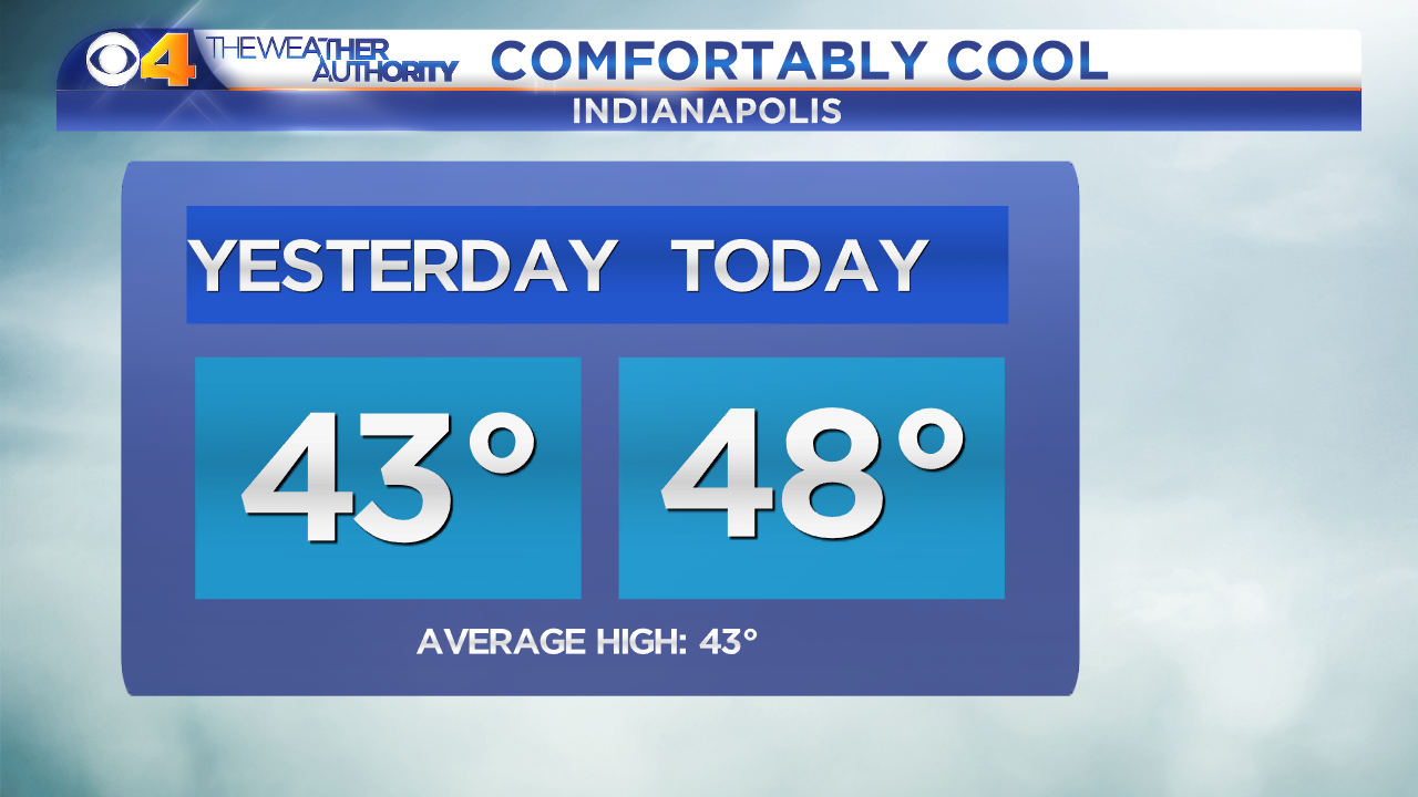 A High of 48 on Friday with no rain will feel ‘comfortably cool’. The light breeze out of the east should not produce much of a wind chill factor so you may find yourself with your coat unzipped but still comfortable all afternoon. Clouds won’t completely exit but some peeks of sunshine are expected.
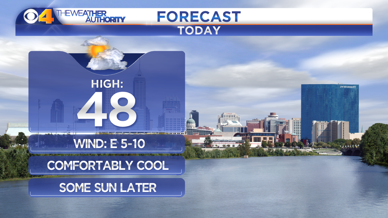 Rain returns Saturday. We could have showers west of Indy as early as 8am with light rain arriving in Indianapolis as early as 9am. We’ll have scattered, light showers all the way through the early afternoon. After 4pm, expect rain to pick up in intensity and you may even hear a few rumbles of thunder.
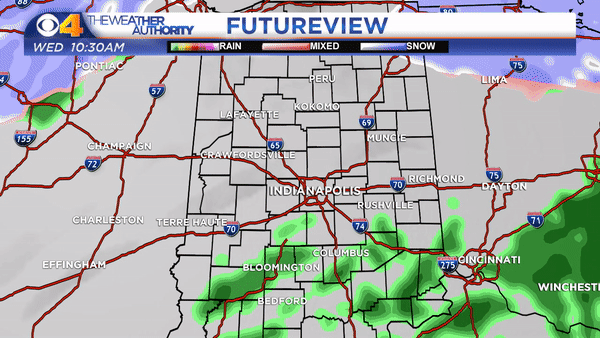 The severe threat for Saturday stays mainly near Memphis, Tennessee. Rain will wrap up as the cold front passes through Saturday night. We could certainly have strong winds Saturday and the wind will get stronger Saturday night and into Sunday. Winds will gust to at least 40mph. Power outages are possible on Sunday where winds gust closer to 50mph.
 The high on Sunday is 48° but that’ll happen around midnight. The cold front passage will drag in much colder air, dropping us to the 30s by Sunday afternoon. Not a great weekend forecast.
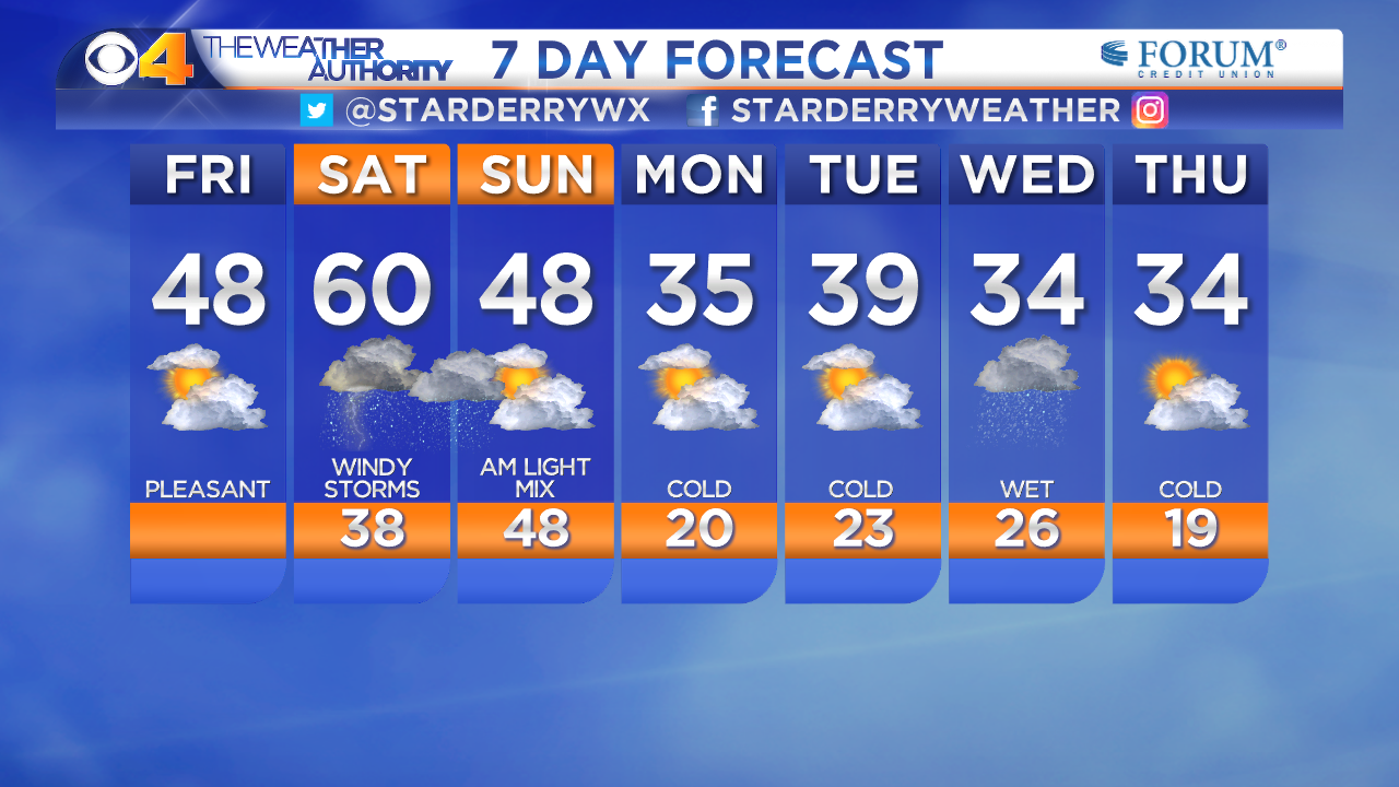
This is an archived article and the information in the article may be outdated. Please look at the time stamp on the story to see when it was last updated.


