
A powerful blast of arctic air has moved across central Indiana and will bring the much colder weather. We’ll have sunshine early Wednesday with a chance for a few flurries late in the day. Lows will be in the teens with highs in the 30s through Thursday. The good news is that the arctic blast won’t last long. Highs will be back in the 40s by the end of the week. Over the weekend we’ll have rain developing Saturday afternoon that will change to snow Saturday night. Some accumulation will be possible by Sunday morning.
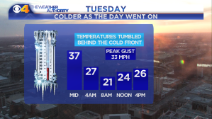
Temperatures fell after a cold front moved across the state Tuesday.
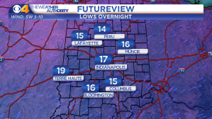
Lows will fall into the teens overnight.

Highs will stay below freezing Wednesday.

Lows will also be in the teens Thursday morning.
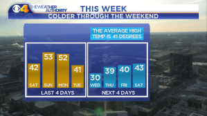
Temperatures will stay chilly through the weekend.
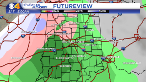
Rain will develop Saturday afternoon.
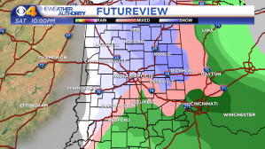
Rain will change to snow Saturday night.


