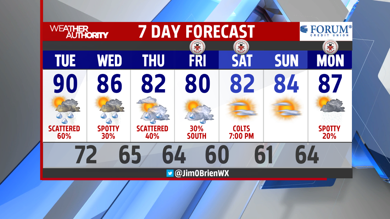
Spotty showers and storms already on Live Guardian Radar this morning! Most of these will weaken around sunrise and remain a non-threat! While more heat and humidity continue to build in, a lot of dry time should be enjoyed through the early afternoon. After hitting 91° on Monday, we could make another run at a 90° day by 4 p.m.


Severe threat will be on the rise around 2 p.m. as storms begin to drift towards Indiana! Timing and direction are pointing to late afternoon for Indiana (roughly 4 p.m.) and with the greatest threat for western and southwestern Indiana (most unstable air). Damaging winds, large hail, heavy downpours and lightning all remain a threat through this evening. Be sure to be severe weather aware and remember that not all of us will be dealing with this type of weather.


Additional rain and storms will remain for parts of the state through Friday. A cold front will slowly push south of the state by Friday afternoon. This will mark a cool down with lower humidity and lower temperatures! A great weekend ahead, including your Friday night outdoor plans.