It is well known, or at least widely accepted, that the physical line or border that separates Nebraska from its two eastern neighboring states is the middle line of the Missouri River. How is it therefore possible for a tract which would almost hold the entire city of Beatrice to be located east of the Missouri River yet be a recognized precinct of Nemaha County and a physical part of Nebraska?
The answer is a bit trickier than why you must drive through Iowa to get to the Omaha airport but is still part of the same question.
Nearly a decade before Nebraska Territory even existed and people crossing the Missouri River spoke of leaving the United States, the McKissick (sometimes McKissock) family, which lived in Fremont County, Iowa, claimed squatter’s rights to the thumb-shaped plot of land across the Missouri in what was then often referred to as Indian Territory, part of the Louisiana Purchase of 1803.
People are also reading…

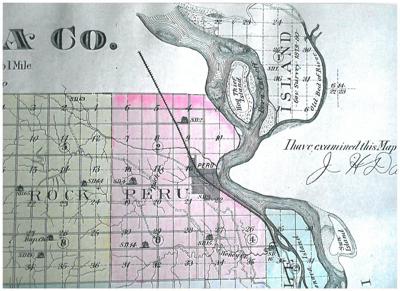
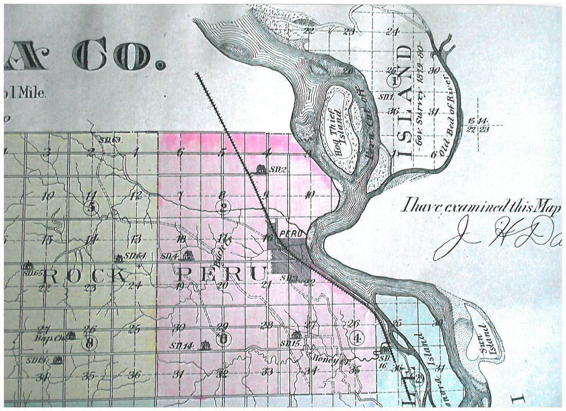
With the creation of Nebraska Territory in 1854 eight counties were designated, including Forney County which would spawn Nemaha County on November 23, 1855. Nemaha County included the thumb of land on its northeast corner, plainly on the west side of the Missouri, which would become known as McKissick Island.
On July 10, 1855 H. S. Thorp opened “the first school in the county” on McKissick Island. As early as 1857 an early settler wrote that “the east line of the county could not be found with an X-ray machine. The center of the current of the Missouri River was made the east line of the state … but the said center has changed with almost every moon.”
With Nebraska’s statehood in 1867 the Missouri River’s mid-point was made the official boundary with Iowa ad Missouri. Then, with the state only months old, on July 5, the river flooded, moving its channel into a more-or-less straight line, effectively cutting off the thumb of about 3.2 miles by 2.2 miles, about 5,000 acres, or eight square mile sections. Suddenly that part of Nemaha County, Nebraska, was, without a bridge, only accessible through Missouri with the nearest town being Hamburg, Iowa. Although it did cut the river distance from Omaha to St. Joseph, Missouri, by about 20 miles, it also left about five miles of road to be maintained by Nemaha County with no way to access them with equipment.
Although a slight flow briefly continued in the old channel, by about 1870 the land within the old loop was silted in and became rich, fertile farm land. At the same time the state of Missouri claimed the new land mass and began levying taxes on it. In 1877 the Missouri River again straightened itself northeast of Omaha creating Cut-Off Lake, later renamed Carter Lake. 1880 saw an ice jam further straighten and deepen the 1867, new channel at Nemaha County.
In 1881 a new log schoolhouse was built on McKissick Island, and in 1897 a Methodist church was constructed. A new school was built in 1903, and in 1907 the island’s population was noted as being 30 families with 56 children, 36 of which were attending the island’s school.
The border dispute raged on with a new survey in 1895 confirming Nebraska’s title which was contested by Missouri, which filed suit in the U. S. Supreme Court in 1904. This resulted in the finding stating that land ownership is defined when “a stream of water, which changes its course … shall still hold by the same boundary, including accumulated soil.” The Missouri/Nebraska Boundary Commission then resurveyed the land setting new stone boundary monuments.
A 1918 newspaper article pointed out that "much of the lumber used by early home builders in Nemaha County came from the cottonwood trees on the island.” The island school closed in 1956 with the students of the seven remaining families admitted to the Hamburg, Iowa, school and the abandoned schoolhouse converted to a polling station. This created an interesting dilemma as the school bus serving McKissick Island students had to be insured in Nebraska, Missouri and Iowa.
A Congressional Act of 1999 gave the land ownership to Missouri but later the same year the Supreme Court said much of the land was still in Nebraska and a Congressional Resolution reaffirmed Nebraska’s ownership.
By 2006 only one house remained on McKissick Island, at 739A Road and 647A Avenue still with a Nemaha County address. Yet another flood of two to 10 feet of water covered the island, removed the house, most of the trees and left only one damaged farm building on 2011 but the following year Nemaha County received $56,988.26 for road repairs from FEMA.
Today only the flood-damaged farm building is left on McKissick Island, all of its property owners live outside of Nebraska, yet McKissick Island is still an official Nemaha County Precinct.
Historian Jim McKee, who still writes with a fountain pen, invites comments or questions. Write to him in care of the Journal Star or at jim@leebooksellers.com.