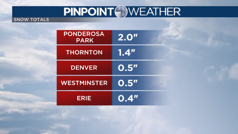
DENVER — Metro Denver had a burst of moderate to heavy snowfall midday on Saturday. Most areas only picked up a half of an inch up to two inches but it was enough to create some slick spots on the roads.
With temperatures staying below freezing on Saturday night, any slick spots from earlier will stay icy.
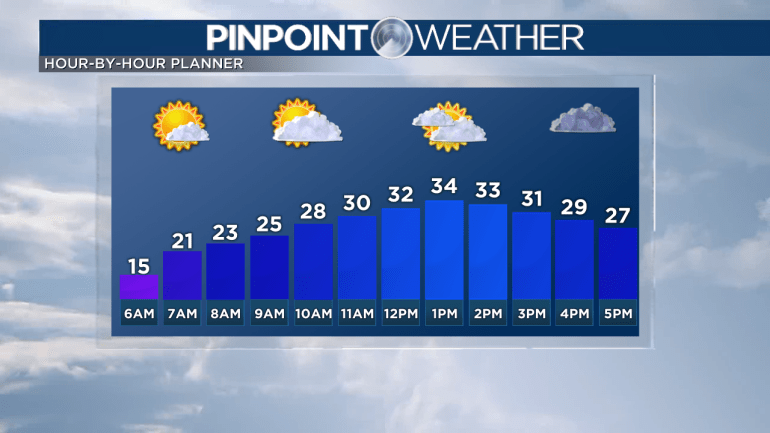
Conditions will clear on the Front Range tonight starting off Sunday dry, sunny, and cold. Afternoon highs will only make it into the mid to low 30s with clouds on the increase.
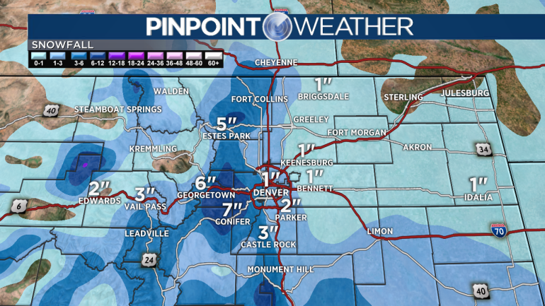
Snow showers will begin in the mountains Sunday morning and will spill onto the Front Range by the evening. Snow will continue overnight Sunday into Monday.
As of right now, we are predicting 1-3 inches of snow in the Denver metro with higher amounts possible on the south and west sides of town where there are higher elevations.
This will be enough snow to create problems on the roads so make sure to allow extra time if you are traveling Sunday night or Monday.
Another round of snow will move in Monday evening into Tuesday. High temperatures will stay well below average in the 20s and 30s all week.
Wednesday will be drier with another round of snow moving in Thursday and Friday.
Check interactive radar and zoom in to where you are. Plus, check the radar anytime with the Pinpoint Weather App for iPhone and Android.

Pinpoint Weather has been independently certified as Colorado’s Most Accurate Forecast by WeatheRate.
We’re tracking weather today on FOX31 Denver and Channel 2 News – and when conditions are bad we send out the Weather Beast.


