Stage I fire restrictions going into effect across central, western Arizona
Jun 20, 2019, 12:58 PM | Updated: 2:40 pm

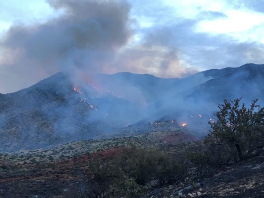
(InciWeb Photo)
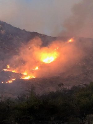
(InciWeb Photo)

PHOENIX – With resources being spread thin as fire activity increases, authorities said Thursday they are implementing Stage I restrictions on state-owned lands over a large swath of central and western Arizona.
The restrictions, which will go into effect Friday at 8 a.m., cover Maricopa, Gila, La Paz and Yuma counties as well as Mohave County south of the Colorado River, the Arizona Department of Forestry and Fire Management announced.
As of 8am Friday, 6/21 – #AZForestry will implement Stage 1 fire restrictions on state-owned/managed lands in #Gila, #LaPaz, #Maricopa, & #Yuma counties & #Mohave – S. of #ColoradoRiver. @MaricopaEmerg @gilacountygov @YumaCountyOEM @TOAD1EBS #AZForestry #AZFire
— AZ State Forestry (@azstateforestry) June 20, 2019
The restrictions won’t be rescinded until the wildfire risk decreases.
Under Stage I restrictions, all campfires and charcoal, coal and wood fires are prohibited except in developed campsite or picnic sites. Smoking is only permitted in an enclosed structure or vehicle.
Fireworks are never allowed on state lands.
Liquid petroleum devices that can be switched on and off can still be used, but it must be in an area clear of surrounding and overhead flammable materials.

The limitations cover the following parts of the restricted zone, except property within incorporated city boundaries:
- State trust lands.
- Game and Fish Commission wildlife areas and department properties.
- State parks (find park-specific restrictions here).
- Arizona Department of Transportation highway and right-of-way property not owned by federal land management agencies.
Any local restrictions stronger than those listed will take precedence.
RELATED STORIES


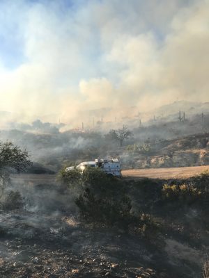
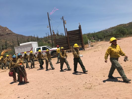
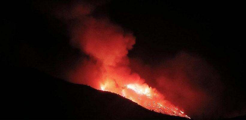
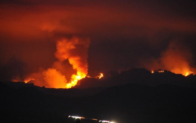
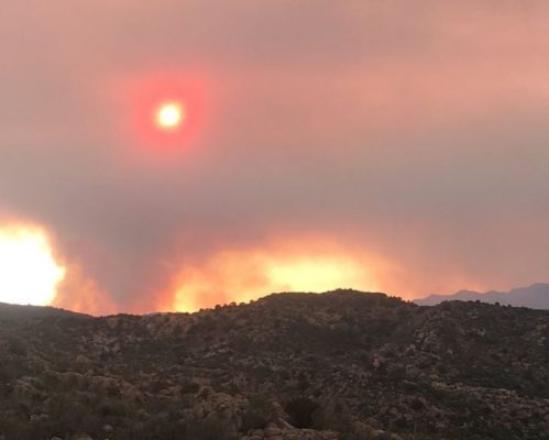
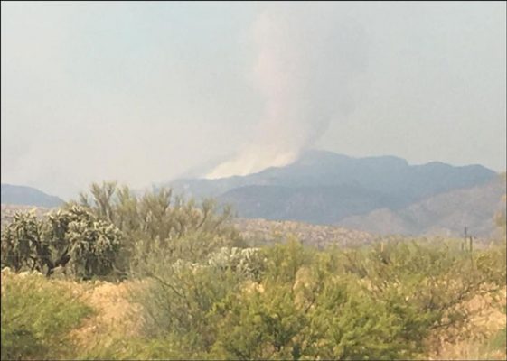
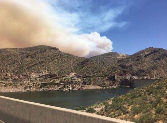
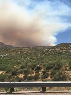
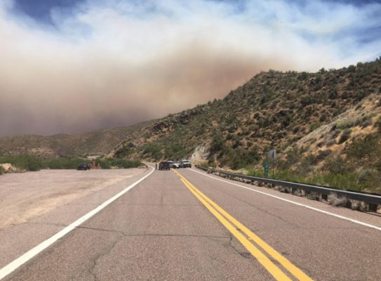
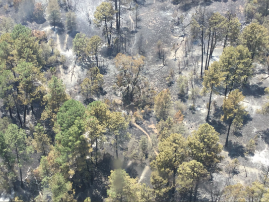
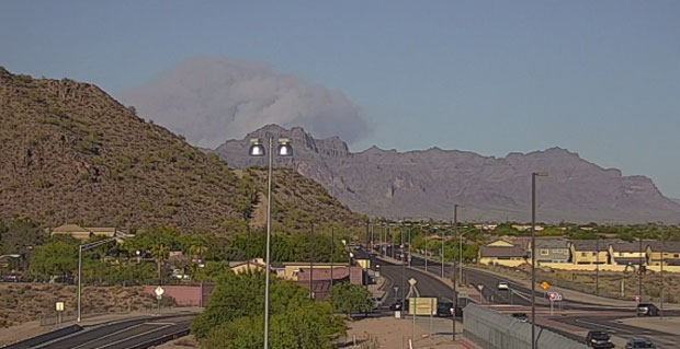
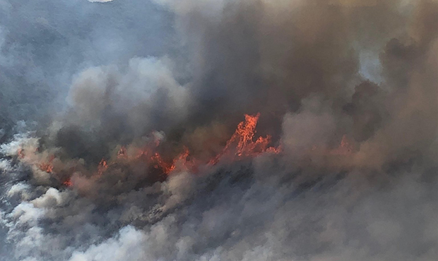
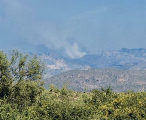
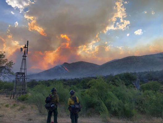
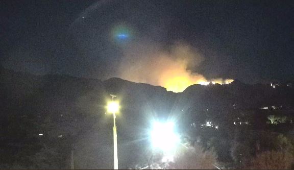
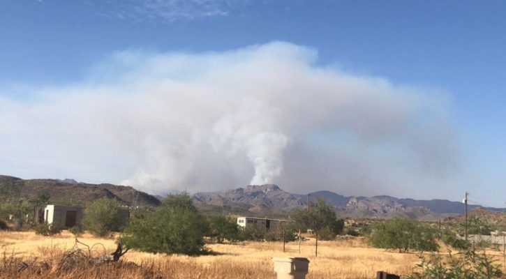
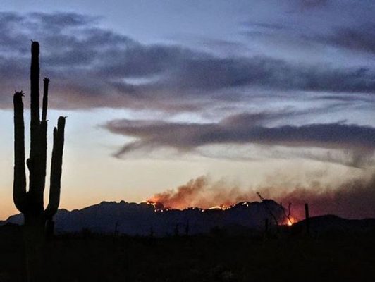
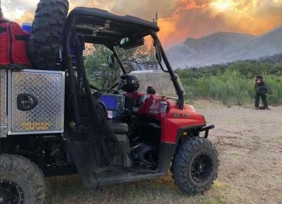
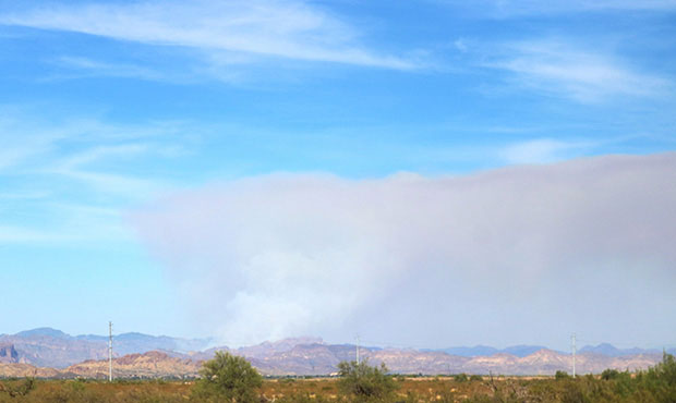
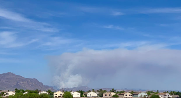
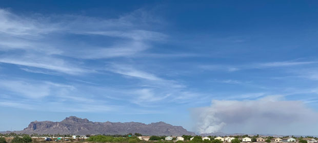
Stage I fire restrictions were already in effect for the entire Tonto National Forest as the Woodbury Fire continued to spread.
The human-caused blaze, which started June 8 about 5 miles northwest of Superior, has yet to damage any structures, but it’s been creeping closer to areas of human activity.
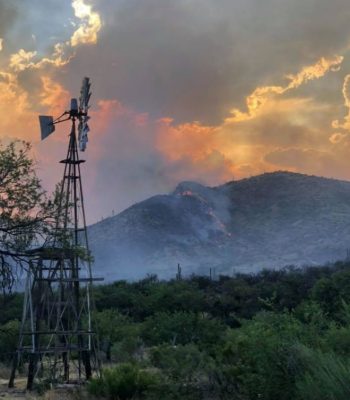
On Thursday afternoon, the first evacuation order was issued in response to the fire, as residents of the Roosevelt Lake area were told to leave their homes.
The American Red Cross Greater Phoenix Chapter opened a temporary shelter for people and small pets at Lee Kornegay School, 4735 S. Ragus Road in Miami.
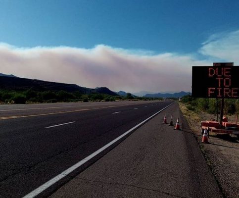
The Arizona Department of Transportation said State Route 188, which runs along the west side of Roosevelt Lake, has been closed from SR 88 at milepost 244 down to SR 288.
An existing closure on SR 88 is still in effect between milepost 213 and SR 188. That closure was longer when it began last week, starting at milepost 201.
The Forest Service said campgrounds at Roosevelt Lake east of Roosevelt Dam were closed Thursday morning.
As of around noon Thursday, the fire had consumed about 50,000 acres and was 41% contained.
“The next three days are going to really test us. The fire last night was very active in Campaign Creek until 2 to 3 in the morning,” Dick Fleishman, Southwest Area Type 1 Management Team spokesman, told KTAR News on Thursday morning.
People can sign up here for emergency notifications from Gila County.
KTAR News 92.3 FM’s Jim Cross contributed to this report.