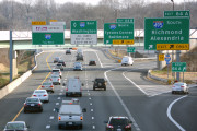
It might have been a far cry from a winter storm, but the chance of an icy start to Friday was significant enough that several D.C. region school districts opened their doors late or closed altogether.
Students of Loudoun, Fauquier and Rappahannock county public schools in Virginia enjoyed a day out of classes Friday, even if widespread traffic issues from icing didn’t materialize. Prince William and Stafford county schools started on a two-hour delay.
An upward trend in temperature means most of the region will soon make the transition from freezing rain to plain old rain and bring an end to this story.
- Listen to WTOP online and on the radio at 103.5 FM or 107.7 FM.
- Current traffic conditions
- Weather forecast
- Closings and delays
- Sign up for WTOP alerts
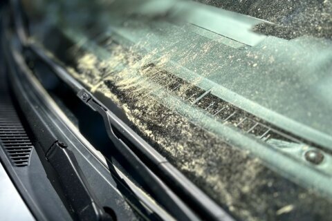
While the rain stayed steady and temperatures cold, pretreated roads and a faster storm motion kept most of the freezing precipitation that fell Friday morning from becoming a big issue in most areas.
Some higher elevations of Maryland and Virginia along the Blue Ridge were reporting trace amounts of ice on the ground around 10 a.m. but D.C. itself dealt with nothing but a miserably cold rain.
The onset of light freezing rain can be the most dangerous travel time as a thin layer of moisture develops on surfaces and freezes into ice. If temperatures are near or below freezing in your area this morning, be cautious as surfaces which look wet could be icy. pic.twitter.com/I0ZtKPzZdb
— NWS DC/Baltimore (@NWS_BaltWash) December 13, 2019
Both Prinzivalli and the National Weather Service agreed areas to the west of D.C. such as the Blue Ridge and Interstate 81 corridor, as well as communities such as Frederick and Purcellville, should expect lingering icy conditions into the afternoon.
“Areas of greater concern for freezing rain and ice accumulations are along and west of U.S. Route 15 from Frederick County, Maryland, southwest into western Loudoun and northern Fauquier Counties in Virginia, and all other areas to the southwest and west,” the weather service said in their Friday morning forecast discussion.
That storm will push north on Saturday morning, bring a warm front and cloudy and damp conditions to the region, with milder highs in the low 50s. There may be occasional showers, but the worst of the winter weather should abate for the weekend.
“By Saturday night, a low pressure center will drag a cold front through the area,” Prinzivalli said, which will bring “drier and cooler air for the second half of the weekend.” Sunday will be partly sunny and breezy, with highs near 50 but winds of 10 to 20 mph.
Prinzivalli warns that the workweek may start off with some messy weather due to a fresh low pressure system.
“We may see a wintry mix of snow, sleet and freezing rain develop Monday morning and continue into the afternoon,” he said. “As temperatures will struggle to reach the middle to upper 30s, we will have the risk of slippery travel conditions Monday into Tuesday morning.”
Current conditions
Forecast
FRIDAY AFTERNOON: Mostly cloudy with steady rain.
TEMPS:Upper 30s
RAIN: 100%
FRIDAY EVENING-Mostly cloudy with light to moderate rain.
TEMPS: Upper 30s/Low 40s
RAIN:90%
FRIDAY OVERNIGHT: Steady rain at times, light to moderate through the early morning hours.
LOWS: Mid to Upper 30s
RAIN: 90%
SATURDAY: Mostly cloudy skies. Rain is likely for first part of day, with decreasing rain chances by late Saturday.
HIGHS: Upper 40s to Low 50s
RAIN: 80%
SUNDAY: Mostly sunny, dry and breezy.
HIGHS: Upper 40s
WIND: W 10-20MPH, G25MPH
MONDAY- Mostly cloudy with a chance of showers.
HIGHS: Low 40s
RAIN: 60%