Here are snow totals from across Vermont
Vermont ski areas received a nice accumulation of powder.
Like the rest of New England, Vermont was treated to wintry weather over the weekend in New England’s latest snowstorm. A range of snow totals piled up around the state as skiers enjoyed the impacts from the storm.
Starting Saturday, the snow increased in intensity overnight. Vermont roads quickly became tough to navigate as = accumulation ranged from 6 inches to more than a foot and a half.
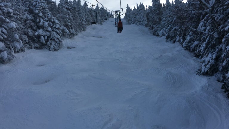
Ski areas were the main beneficiary of the new snow. Stratton Mountain recorded 11 inches at 7 a.m., Bolton Valley noted 14 inches at 11 a.m., while Killington claimed 18 inches around 2 p.m.
Powdahhh Update: 18″ in the last 24hrs and counting. https://t.co/GRI3dHZKiN Photo from today. #beast365 #winterstormharper #showyoursnow pic.twitter.com/vit8i7GmDh
— Killington Resort (@KillingtonMtn) January 20, 2019
Around the rest of the state, the storm’s impact ranged, according to the National Weather Service:
Turnbridge: 18 inches (5:23 p.m.)
Sudbury: 18 inches (5:06 p.m.)
Ferrisburg: 17 inches (4:47 p.m.)
Braintree: 16 inches (10 a.m.)
Enosburg Falls: 16 inches (5:15 p.m.)
Newark: 15 inches (6:30 p.m.)
Burke Hollow: 15.4 inches (2 p.m.)
South Burlington: 14.5 (4:17 p.m.)
Middlebury: 14.2 inches (12 p.m.)
Woodstock: 14 inches (8 a.m.)
Montpelier: 13.5 inches (12 p.m.)
Greensboro: 13.2 inches (12:35 p.m.)
West Rutland: 10.8 inches (6:15 a.m.)