

 Several parts of India are facing severe floods. Photo credit: PTI
  Several parts of India are facing severe floods. Photo credit: PTI
 Several parts of India have faced severe floods this year. Satellite images have captured some of the severely-affected areas in Southern India and highlight the extent of flooding in parts of Kerala, Karnataka and Andhra Pradesh. The images show how the floods grew in intensity from July 29 to August 10. Even as the second spell of monsoon subsided in these states, lakhs of people are still housed in relief camps, waiting for floodwaters to recede.
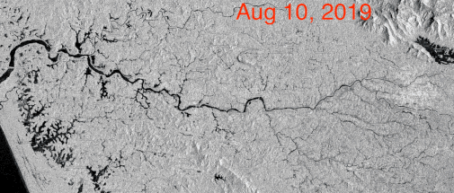
Periyar, Kerala
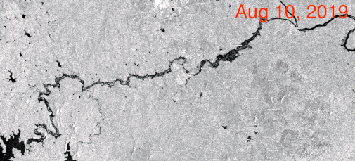
Bharathapuzha, Kerala
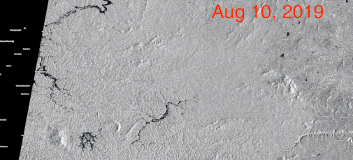
Wayanad, Kerala
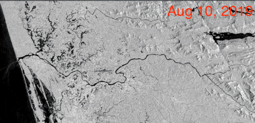
Kabini River, Karantaka
Srisailam, Andhra Pradesh
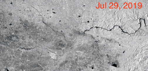
The black area in the pictures above is water. The changing frames show how water increased in the flood-affected areas between July 29 and August 10.
In the above images, we can see the flood situation in Periyar, Bharathapuzha and Wayanad in Kerala, along the Kabini River in Karantaka, and Srisailam in Andhra Pradesh.
"Most of these areas are low lying areas, paddy fields. Some wetlands area like Kole, Kuttanad is often flooded in monsoons. These are also paddy fields but covered with water right now," Raj Bhagat Palanichamy, an Earth Observation Expert at WRI India, told India Today.
With the rains abating in parts of Kerala, water receded in many low-lying areas of the flood-hit state. Meanwhile, there was widespread rain in coastal and Malnad areas of Karnataka. The toll in two states rose to 170, while 48 were still missing. Over five lakh people have been housed in around 2,000 relief camps in the two states.
ALSO READ: Karnataka floods, landslides brew fresh troubles for coffee for second year straight
Copyright©2024 Living Media India Limited. For reprint rights: Syndications Today

