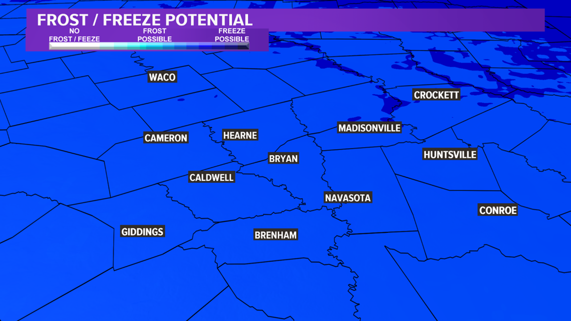
BRYAN, Texas — Light winds, low dewpoints & clear skies will allow Monday night to feature cold temperatures across the Brazos Valley. When you head out of the door Tuesday morning, temperatures will be in the 30s area-wide. Frost is likely with a few rural, low-lying areas falling below freezing.


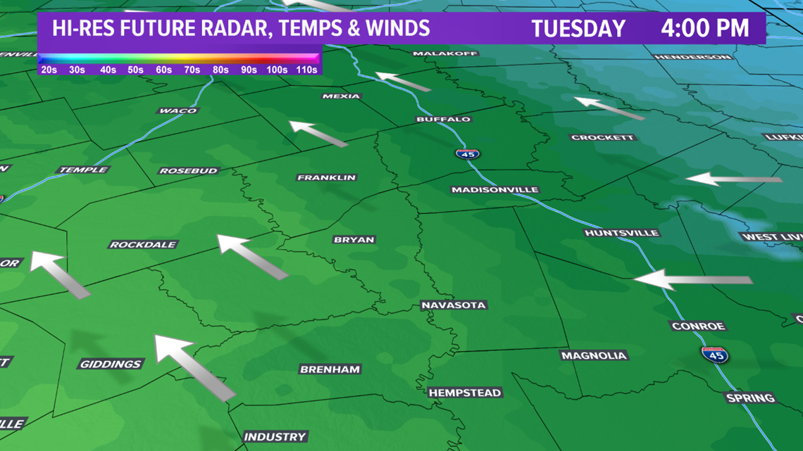
An upper-level disturbance will approach Texas on Tuesday. This will allow a gradual return of Gulf moisture throughout the day as well as an uptick in moisture. Temperatures will climb into the mid-to-upper-50s across most of the Brazos Valley. The northeastern zone will stay a touch cooler, in the upper-40s, as a backdoor cold front sneaks in from the northwest. This backdoor front won't have much "punch" to it so it shouldn't move west of I-45. This reinforcing surge of modified Arctic air is extremely important to the forecast Tuesday night/Wednesday morning.

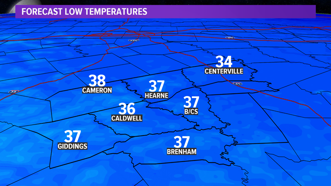
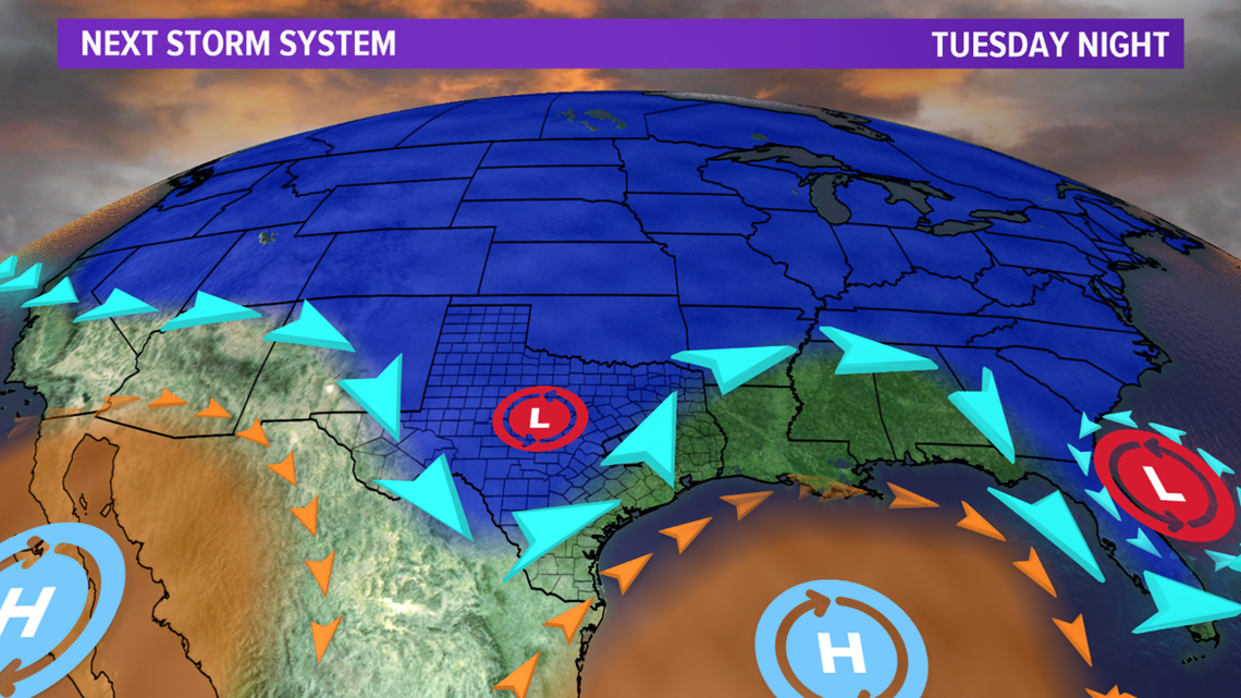
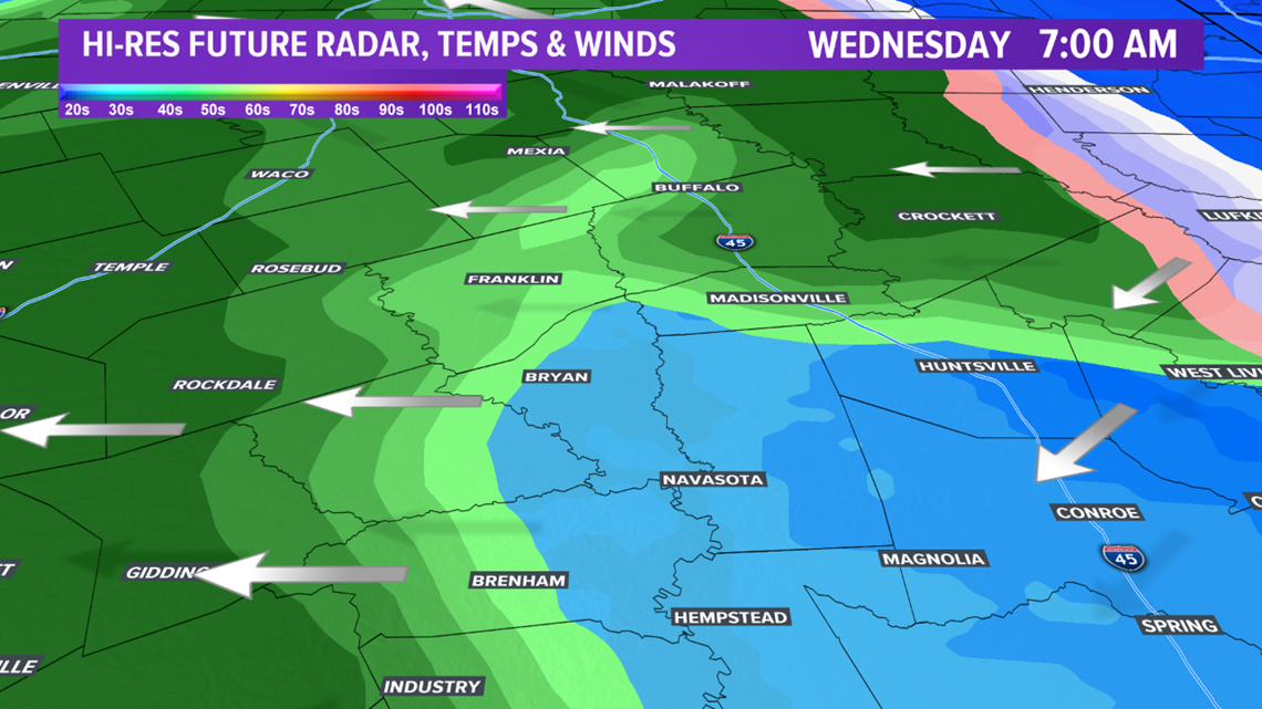
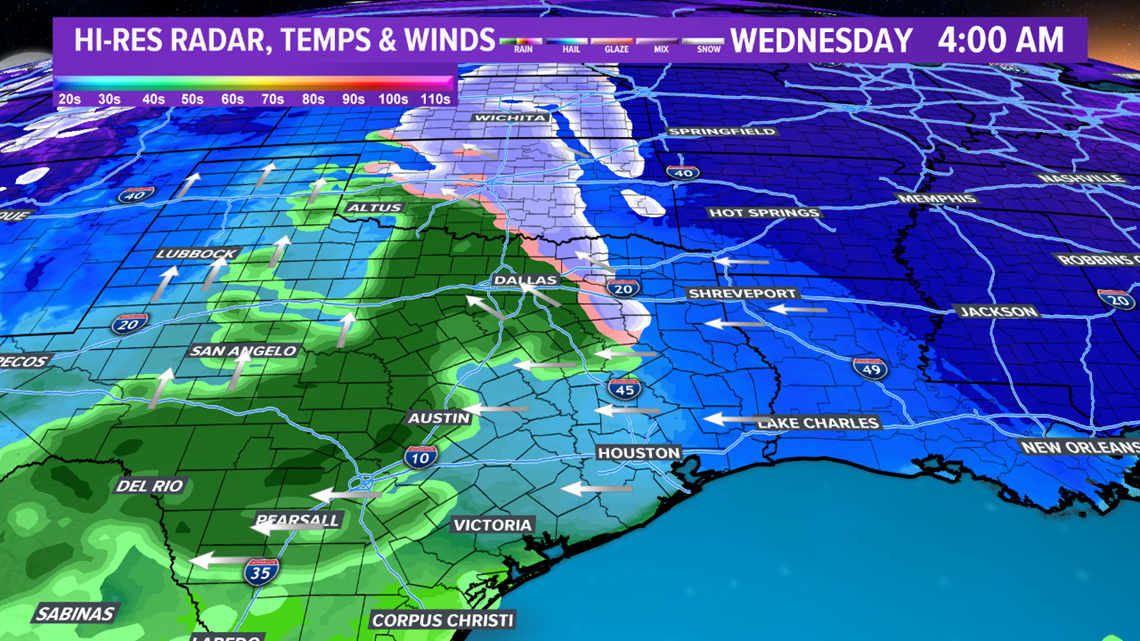
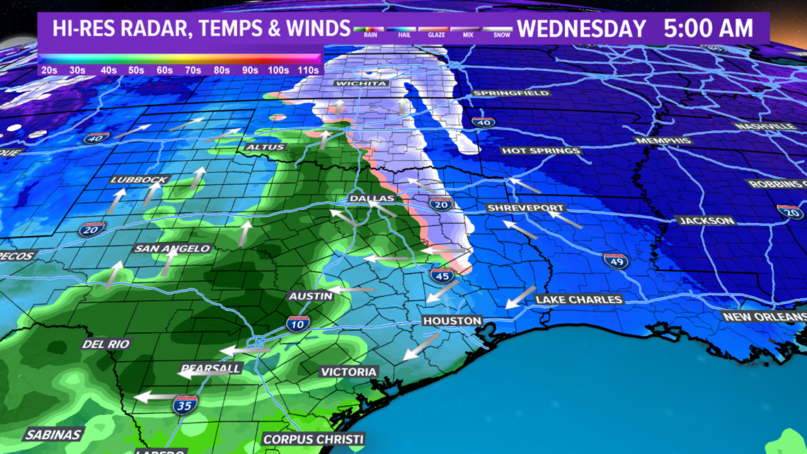
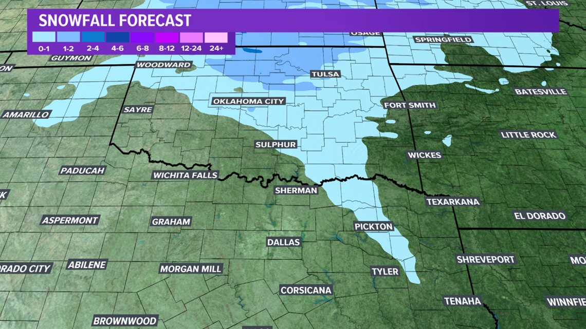
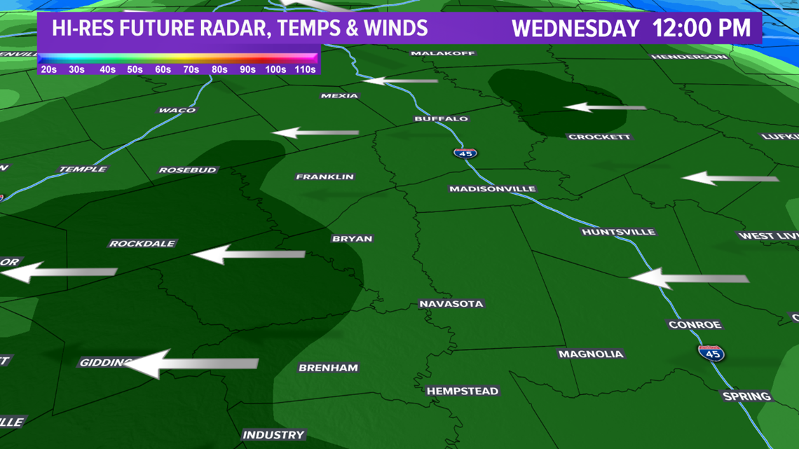
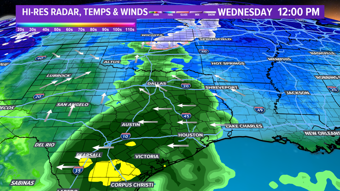
As the disturbance nears late-Tuesday, an area of precipitation will develop across western Texas & the Texas Hill County. This shield of precipitation will advance east overnight Tuesday into Wednesday morning. Temperatures will be cold as the precipitation moves into the Brazos Valley. Most areas will see temperatures range from 35 to 38 degrees. A few areas across the northeastern zone will see temperatures a touch colder thanks to the backdoor cold front. Temperatures across the northeast will range from 32 to 34 degrees. Forecast soundings, which allow us to view the temperatures & dewpoints throughout the atmosphere, show a brief period of snow is possible for the northeastern zone. The best window for snow will be from 4:00 am Wednesday through 9:00 am. There may be a coating of snow but most areas that see snow will not see any accumulations. It should be noted: most of the Brazos Valley will only see rain, including Bryan-College Station. A rain jacket will be needed as you head out of the door Wednesday morning.


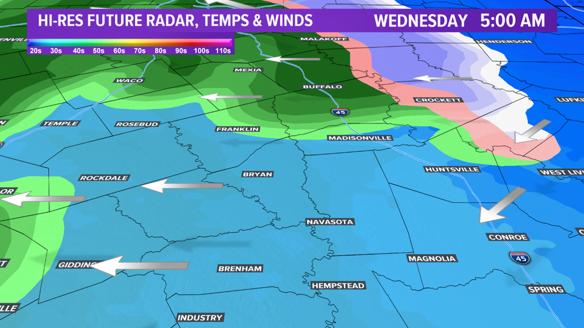

Farther north across eastern & northeastern Texas, there is a better chance for snow and possible accumulations. Temperatures in this area will be colder paired with a longer window of snow potential. These areas have the chance to see 1-2" of snow. This is something to be mindful of if you have any travel plans to the northeastern Texas.


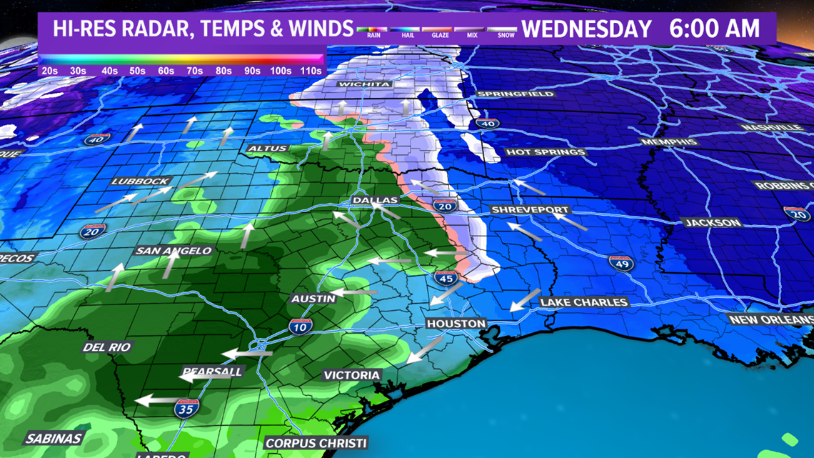

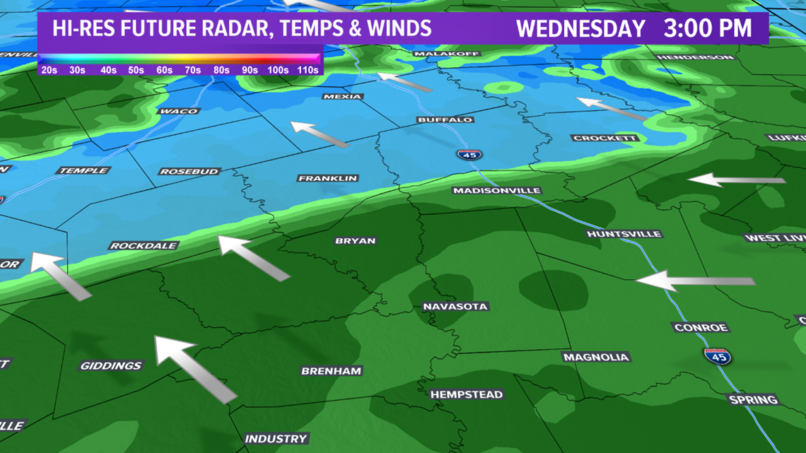
Temperatures will gradually warm, which will allow snow to quickly changeover to rain across our northeastern zone of the Brazos Valley as well as eastern & northeastern Texas. The rain will continue throughout Wednesday. There may be a gradual decrease in coverage by late-afternoon as the shortwave moves out of the region. However, another fast moving disturbance moves overhead late Wednesday, creating another uptick in precipitation as a weak coastal low develops. At this point, moisture will continue to deepen & temperatures will warm, creating enough energy for isolated thunderstorms Wednesday afternoon. No severe storms are expected.


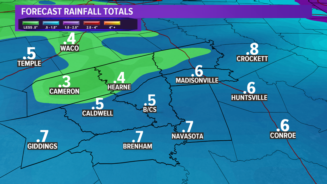
Rain chance will linger into Thursday morning before a drier airmass works into the Brazos Valley by midday. Rain amounts for the area will exceed 0.25" with some areas receiving 0.50'-0.75".