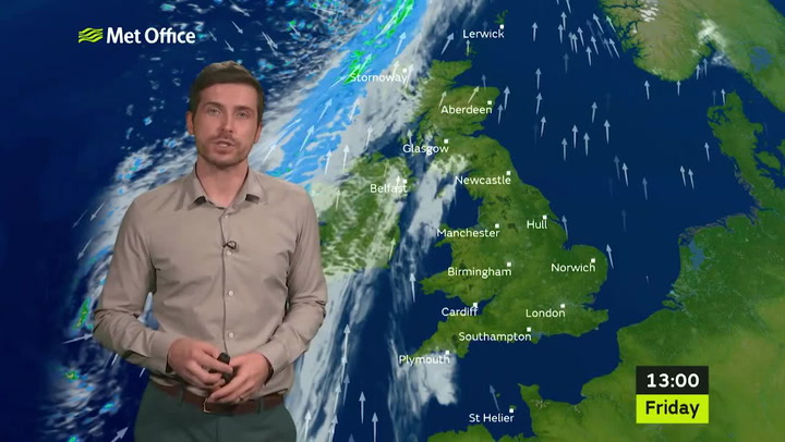
Manchester will be as hot as Greece this weekend with mild temperatures and plenty of sunshine.
Temperatures are above average for this time of year in the region, with highs of 12C to 13C forecast - the same as in the Greek capital city of Athens.
It will come as good news for those hoping to make the most of the half term holidays, with the weather expected to be mainly dry across the weekend.
On Friday there was a bit of freezing fog first thing, but this will melt away later on as temperatures warm up.
It will be mainly a sunny day, with some patchy cloud and highs of 13C.
Later on it may turn breezier and there could be some light rain in places.
Read more of today's top stories here
Overnight temperatures are expected to dip to around 5C.
Saturday will be more or less the same with patchy cloud and some sunny spells.
It will be windy at times, but temperatures will remain mild with highs of around 13C.
Sunday is the best day for indoor activities as cloudier skies and blustery rain is expected in the afternoon.
However, temperatures will again remain mild with highs of 12C to 13C.

The mild conditions are expected to continue, but temperatures will dip slightly on Monday.
Forecasters have said to expect highs of 10C as well as the risk of some heavy showers.
By Tuesday the rainshowers will clear and the Met Office have said to expect a fine day, once the morning fog clears.
Temperatures will remain at around 10C, but due to a chilly wind it will feel cooler at around 5C-7C.
Forecasters have said temperatures will begin to cool slightly as next week continues.
Pressure will build again by Tuesday and it is likely we could see early morning frost again.

A spokesman for The Weather Channel said: "Pressure should begin to build again on Tuesday and there is the risk of an early frost.
"But this should soon clear to leave another dry and bright day. Temperatures will continue to be subdued a little on Tuesday with winds veering northwesterly and ‘feels-like’ values of just 5-7C
"More settled and mild conditions should take charge for the remainder of the week. Pressure should start to build again in the south resulting in milder weather returning but it could still be unsettled in parts of the north."
Grahame Madge, spokesman for the Met Office, said: "We have enjoyed high pressure bringing up warm air. We saw the warmest day of the year so far yesterday. We are likely to have a good day today.
"The story for the weekend is that we have a cold front moving to the North West. That cold front will stall over the North West.
"Any rain will be fine drizzle. It will be cloudy over the weekend, but there will be out breaks of sunshine."