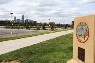

Once again, water from the nearby Missouri River was creeping toward the base of Council Bluffs’ Missouri River levee system Monday, partially flooding ground on the wet side of the levees.
River water covered about one-third of Harrah’s north parking lots Monday afternoon.
Doug Drummey, CEO and general manager of the Council Bluffs Water Works, keeps a near-constant watch on river levels, the primary source of the city’s water and a threat to the city’s North 25th Street purification plant when levels move above flood stage.
“There’s been a lot of rain north of us, and the levels of the Missouri River and the tributaries that flow into it are high,” he said.
Drummey said that the river level in Council Bluffs was 23 feet last Thursday and had risen nearly five feet as of Monday.
People are also reading…
“That’s a big increase, pretty fast,” he said.
To address the high water levels, the U.S. Army Corps of Engineers announced Monday it was reducing the flow from the Gavins Point Reservoir from 58,000 cubic feet per second to 40,000 cubic feet per second. Releases will remain at the reduced level until the Missouri River crests near Sioux City, which is expected in the next several days.
Drummey said the river is expected to crest here at 28.3 feet — 0.7 foot below what the Corps of Engineers considers minor flood stage — about 7 p.m. today. At 11:45 a.m. Monday, the river stage stood at 27.75 feet at Council Bluffs.
He said the river’s flow past the U.S. Geological Survey’s monitoring station on the west side of the Missouri River at the Interstate 480 bridge is 97,300 cubic feet per second, the highest it’s been in 64 years and higher than the flow on this date during the flooding of 2011.
Today’s expected river crest will be in the Top 10 since the Corps began keeping records in 1881, Drummey said.
“Five of the 10 highest Missouri River crests have occurred since 2010,” he said, “and seven have occurred since 1993. The seventh highest crest on record occurred on June 29 of this year.”
Drummey said the reservoirs behind the Gavins Point dam and the five other reservoirs in the Corps of Engineers system contain more water at this time than they did at this time in 2011.
He said river levels here should be back down to 23 feet by early next week. At that time, releases from the Gavins Point dam will be increased to 58,000 cubic feet per second in order to create space in the reservoir system for runoff in the Missouri River watershed in 2019.
Public Works Director Greg Reeder said the city’s flood gates have been closed since June and won’t be reopened until the river level drops to 19 feet.
“The biggest problem for the city is that the river has remained high,” he said.” It’s not so much the height of the river but the duration that causing the problems. It’s eerily like 2011 when the river went up and didn’t go down.”
The high ground water levels have resulted in damage to the city’s storm water pipes and created several sink holes in the northwest part of the city.
Reeder said estimates are that it will cost approximately $2.8 million to repair the damage resulting from the continued high ground water levels.
“We’re going to have to determine what can be delayed or eliminated from the city’s capital improvement program to address the damage,” he said.