
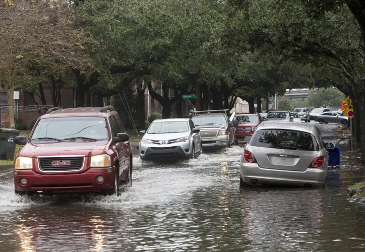


Charleston's flooding woes aren't over yet.
After two days of unusually high tides that inundated roads and left cars stranded, officials are warning residents to prepare for another wet morning on Sunday.

While not as high as the tides on Friday or Saturday morning, Sunday's cycle is still capable of producing significant flooding in downtown Charleston and surrounding areas, said Neil Dixon, a meteorologist with the National Weather Service's Charleston office.
"We could see water return to the roads (Sunday) morning but not to the (same) degree," Dixon said.
The Holy City saw its sixth highest tide on record Saturday morning, which crested at 8.76 feet, exceeding levels seen during the 1,000-year flood event in October 2015 but lower than a high tide recorded on Jan. 1, 1987, he said.
The observed high tide at the Charleston Harbor tide gauge peaked at 8.76 ft MLLW at 8:18 AM. The tide was the 6th highest in the history of the gauge, surpassing the historic October 2015 event. Flooding was observed from 6:18-10:24 AM. https://t.co/PITUeWZ6JM #chswx #scwx pic.twitter.com/TYLsGeviBJ
— NWS Charleston, SC (@NWSCharlestonSC) November 24, 2018
Friday morning also saw tides peak at higher than 8 feet, putting significant parts of the peninsula under water.
Saturday's tide was highly unusual because it reached areas typically untouched by this kind of flooding, according to officials.
Here is a collection of flood reports from this morning's high tide. It is noteworthy to see tidal flooding as far inland as Hanahan and the Francis Marion National Forest. Details: https://t.co/sSiAcktHq1 #chswx #savwx #scwx #gawx pic.twitter.com/MYF7VM5c8l
— NWS Charleston, SC (@NWSCharlestonSC) November 24, 2018
"It is noteworthy to see tidal flooding as far inland as Hanahan and the Francis Marion National Forest," the Weather Service stated.
Water levels were so high that Ron Morales, a meteorologist at the Weather Service's Charleston office, said they approached heights seen during hurricane or tropical storm conditions.
The water also took longer than usual to recede, Dixon said.
A typical coastal flood advisory lasts somewhere between 30 minutes to an hour, he said.
On Saturday, the Weather Service's alert was in place for roughly 4 hours.
Dixon suspects that is part of what allowed water to reach so far up rivers and why roads were impassable for so long.
"We're still seeing pictures of water standing on roads downtown," Dixon said around noon. "It may take some time for that to drain away
Lockwood Dr. at the City Marina. pic.twitter.com/N6jLKz2BCx
— Michelle McLeod (@chellemi31) November 24, 2018
As roads in Charleston and surrounding areas began to reopen early Saturday afternoon, he and other officials stressed that drivers should still be wary of lingering pockets of flooding.
As for Sunday?
The morning tide will crest at 7.7 feet — roughly a foot below Saturday morning's high but nearly a foot above Charleston Harbor's flood stage of 7 feet, Dixon said.
Worse flooding than Matthew here at the Geechie Dock on Shem Creek. It’ll be a while before we can deliver fish @chswx @NWSCharlestonSC pic.twitter.com/7Km9DNaMTF
— Mark Marhefka (@AbundantSeafood) November 24, 2018


