


Florida’s Indigenous Heritage Faces a Watery Grave
This article was originally published at The Conversation and has been republished under Creative Commons.
Native North Americans first arrived in Florida approximately 14,550 years ago. Evidence for these stone-tool–wielding, megafauna-hunting peoples can be found at the bottom of numerous limestone freshwater sinkholes in Florida’s Panhandle and along the ancient shoreline of the Gulf of Mexico. [1] [1] Analise Hollingshead, a former graduate student at Florida State University, contributed to this article.
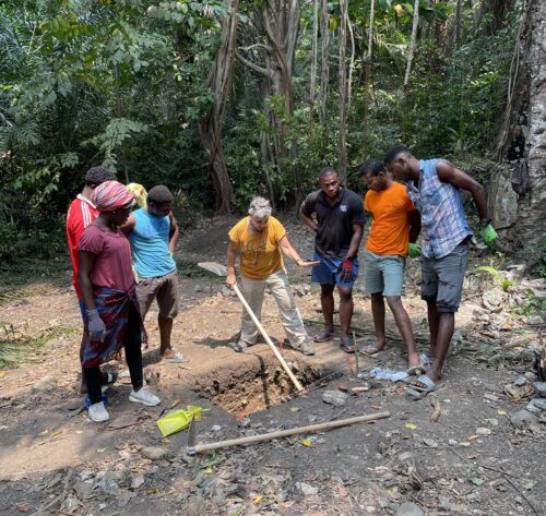
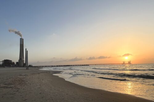
Specialized archaeologists using scuba gear, remote sensing equipment, or submersibles can study underwater sites if they are not deeply buried or destroyed by erosion. This is important because Florida’s archaeological resources face significant threats due to sea level rise driven by climate change. According to a new U.N. report, global sea levels could increase by over 3 feet by the year 2100.
Archaeological sites contain evidence of what people ate in the past, what kinds of houses they built, how they buried their dead, and what they did to memorialize stories, leadership, and community. These places literally embody human lives and are the only records we have of ancient Indigenous peoples of the New World.
Between the years 1500 and 1850, 2.5 million Europeans migrated to the New World. As a consequence of their arrival, 50 million Indigenous people died from disease, massacres, and slavery.
As scholars who study anthropology and archaeology, we believe that the genocide of these oral historical and literate societies, native to North, South, and Central America, makes it even more important to preserve their ancient sites. Without them, we may never be able to learn the history of the first peoples of this land.
Valuable and vulnerable
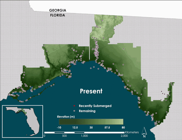
At present, 1,539 archaeological sites are located at or below sea level in Florida. By 2100, up to 6,820 will become submerged by sea level rise.
Florida’s Big Bend region—the eastern half of the Panhandle—contains 541 Native American archaeological sites, found from the coast to inland hills and river valleys. They include earthen and shell mounds, and shell middens, or refuse heaps. These sites belong to Deptford, Swift Creek, Weeden Island, or Fort Walton and Apalachee cultures, and represent a time period of over 2,000 years of occupation, from 500 B.C. to A.D. 1540.
We want to see lesser-known features of America’s past documented and saved.
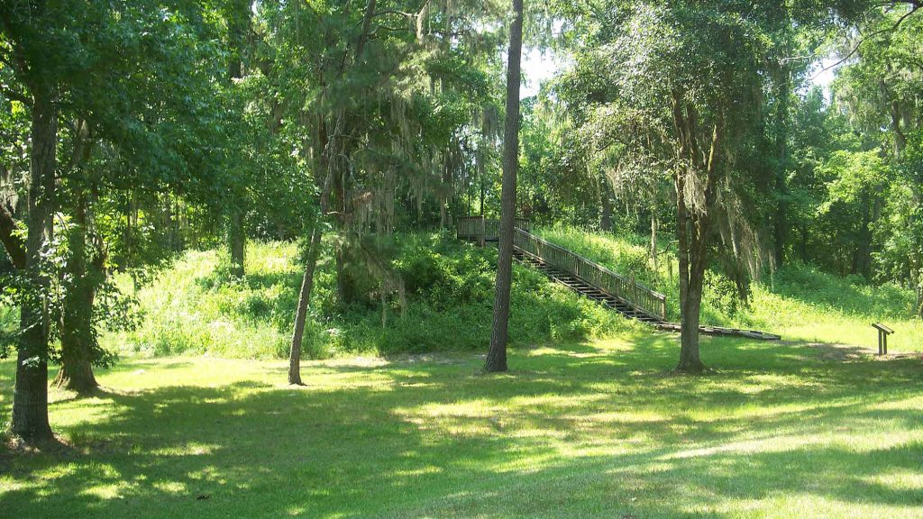
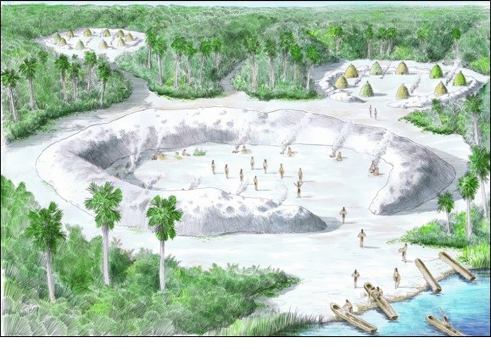
Notable sites in this region include Mound Field, Bird Hammock, and Garden Patch—places where hunter-fisher-gatherers built monuments, traded for goods, and practiced crafts such as basketry and bead and pottery production.Archaeological sites belonging to these cultures in the Gulf of Mexico region represent a continuation of earlier lifeways dating as far back as 7,000 years ago. But they also mark shifts in ceramic and stone toolmaking technology, and significant changes in ceremonies associated with monument construction and burial of the dead.
The Garden Patch site, a barely investigated Middle Woodland shell midden and six-mound complex, is one of Florida’s innumerable cultural resources at risk. With roughly 5 to 6 feet of additional sea level rise, most low-lying areas at the site will be flooded, and saltwater will kill grasses and trees. With no tree cover or vegetation, the site’s mounds, middens, and mortuary remains will erode away and be permanently destroyed.
There are cost-effective ways to stabilize the site and make it more resilient to climate change. They include planting salt-tolerant grasses and shrubs, such as spartina and saline-adapted mangroves, and building sea walls and levees to redirect water. However, studies show that hard systems like this are not always effective and can have negative environmental effects on surrounding areas.
An even more effective response is raising public awareness of America’s Native and Indigenous heritage, and encouraging study of these sites while they are still above water.
Saving stories by saving places
Other parts of the Gulf Coast, such as the Mississippi River Delta and coastal Louisiana, are comprised mainly of low-lying marshes that are extremely vulnerable to sea level rise. In contrast, Big Bend interior cities, like Tallahassee, will be relatively well-protected by geographic features that prevent seawater from penetrating far inland.
Except for universities, hospitals, and government in Leon County and Tallahassee, the main industries in the coastal Big Bend region are fishing, farming, and tourism, and the population of the entire area is just 500,000. Relatively few people in this part of Florida will be affected by rising seas compared to large, low-lying cities like Tampa, Miami, and Jacksonville, with a collective population of 9.6 million people.
However, infrastructure along the coast will be significantly affected. For example, St. George Island State Park, which is on a 28-mile barrier island, incurred over US$5 million in damage from Hurricane Michael in October 2018, and the entire island will be inundated with as little as 3 feet of sea level rise.
American history is Native American, African American, Latinx (of Latin American heritage), Asian, and European. Our cumulative story begins 15,000 years ago and ends when we decide. In our view, Americans and scholars have an obligation to try to save our collective histories.
By advocating for the study of the past, we hope to encourage documentation of endangered landscapes, collaborative data recording, multi-agency partnerships, and acknowledgment that the U.S. is going to lose sites that are part of its heritage. Rather than focusing on preserving singular parts of America’s past, like <a href=”https://www.nps.gov/jame/learn/historyculture/a-short-history-of-jamestown.htm”>Jamestown, Virginia</a>, the first permanent English settlement in North America—which is also in a low-lying and threatened environment—we want to see lesser-known features of America’s past documented and saved as well.
As we see it, Americans’ collective identities are rooted in a shared past and in physical landscapes and places. That makes saving these places important. The first step is talking about them. The next step begins when scholars and the public come together to learn about the past and advocate for preserving it.

Jayur Madhusudan Mehta is an assistant professor in anthropology at Florida State University, specializing in the study of North American Native Americans, human-environment relationships, and the consequences of French and Spanish colonization in the Gulf South. He has led archaeological excavations in both the U.S. and Mexico, and he recently appeared in the documentary Keepers of the Mound. Mehta, a National Geographic Society research fellow, has published research in the fields of environmental archaeology, ethnohistory, and Indigenous religious and ritual practices. He is also an executive board member of the Gulf Communities Research Institute, a Louisiana-based nonprofit that works to preserve the health, resilience, and lifeways of coastal communities threatened by sea-level rise and climate change. See the Adams Bay documentary for more information.

Tara Skipton is a graduate student in archaeology at Florida State University.
