
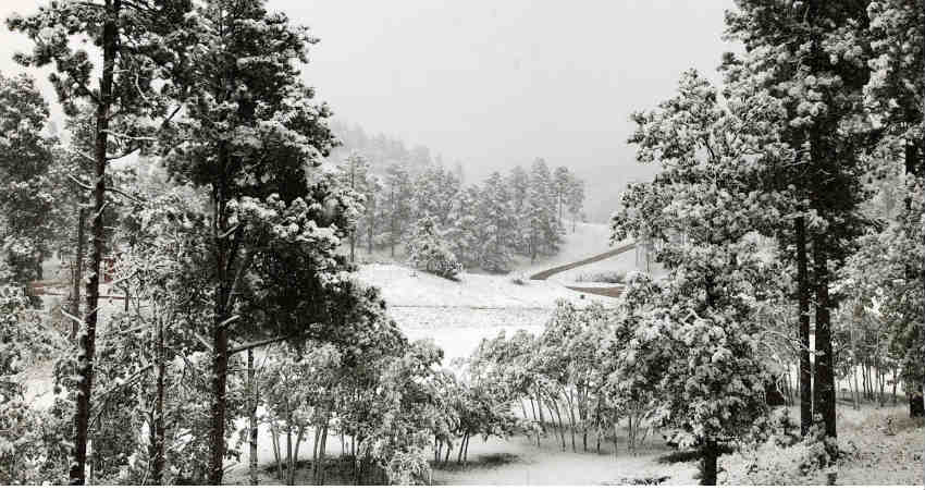
Snow in the hills is the main attraction for the tourists and also it is the lifeline for the residents of the hills of North.
All the ranges that are low, mid and high range hills witnessed snowfall this November. By December, the snowfall activity becomes widespread. February month sees a peak in the snowfall activity while January also witnesses snowcapped mountains.
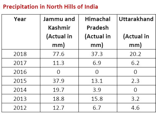
Jammu and Kashmir witness the maximum amount of snow in the month of November which is then followed by Himachal Pradesh and Uttarakhand.
This year likewise last year, early snowfall activity has been a sight. The first snow in November this year was witnessed on 06th while last year it was observed on November 03.
To date in November, we have had two active Western Disturbances which had largely impacted Jammu and Kashmir as a fair amount of good snow activity has been seen.
If we look at the data then until today, Jammu and Kashmir are large excess and stand at 100.9 mm of precipitation activity against the normal of 16.1 mm. Similarly, Himachal Pradesh is excess and stands at 21.1 mm against the normal of 9.2 mm. While Uttarakhand is a deficit and stands at 2.2 mm against the normal of 4.0 mm.
It was in 2018 in November when all the three hill stations of North India performed in large excess. On the other hand, 2016 was the other extreme as nil activity was a sight.
In Uttarakhand, it is generally the upper reaches which get mainly affected by rain and snow activities.
Image Credits – Keloland
Any information taken from here should be credited to Skymet Weather
