
A flash flood on Northeast Alabama's Little River on Easter Sunday notched the fourth highest water level on record going back more than 90 years, shifting the river channel and causing significant damage to park facilities.
Rainfall totals in the first three months of 2020 reached almost 25 inches in Chattanooga region, and more than 100 tornadoes raging across the South late on Easter Sunday, leaving at least 36 dead in a storm system that brought more than 3 inches of rain to North Alabama that weekend, according to National Weather Service preliminary data.
That torrential rain that evening ravaged the federal preserve, resulting in a flash flood at Canyon Mouth Day Use Area in Cherokee County, Alabama, Little River Canyon National Preserve spokesman Matt Switzer said.
The area is near the downstream end of the preserve where the Little River exits the canyon and makes its way a few miles downstream to Weiss Lake. The main river channel now flows from the Canyon Mouth Picnic Area south along County Road 275, under Alabama Highway 273 then rejoining the former channel a little upstream of Big Oak Campground on Weiss Lake.
The Little River notched on East Sunday night the fourth highest water flow on record, dating back to 1929, Switzer said. According to the U.S. Geological Survey gauge at Canyon Mouth, the volume of water in the river exceeded 36,000 cubic feet per second.
"Average flows there are on the order of [200-300] cubic feet per second. This was an extreme storm event," park superintendent Steve Black said.
Black said the flooded river did significant damage to park facilities and caused the river to move its channel to an older channel farther south.
At low flows, the previous channel is now mostly bypassed for about a mile, with the river now flowing in the southern channel until the two merge again downstream.
"At higher flows, above approximately 600 cubic feet per second, the previous channel still flows," Black said.
Damage at the Canyon Mouth Day Use Area has already been completed, but park officials have no plans for trying to move the channel back to its previous alignment, Black said.
(READ MORE: Little River Canyon Bridge among Sierra Club's top picks projects.)
"From the National Park Service's perspective, this was a natural event. Our policy and indeed the park's enabling legislation make it illegal for us to alter what Mother Nature has done on her own accord," Black said. "We have no idea whether the channel will eventually shift back to its previous alignment.
"Rivers are naturally dynamic, particularly in delta areas, and Canyon Mouth is essentially a delta," he said.
According to federal officials, park staff are seeking help from experts within the agency, both with the regional office in Atlanta and with the agency's Water Resources Division in Fort Collins, Colorado.
"All agree that this was a natural event," Black said. "Our mandate is crystal clear. That river must be left to choose its own path."
Little River Canyon National Preserve was established in 1992 as a unit of the National Park System. Today it encompasses more than 11,000 acres. The river itself originates atop Lookout Mountain and flows more than 30 miles before emptying into Weiss Lake, according to park information.
Contact Ben Benton at bbenton@timesfreepress.com or 423-757-6569. Follow him on Twitter @BenBenton or at www.facebook.com/benbenton1.
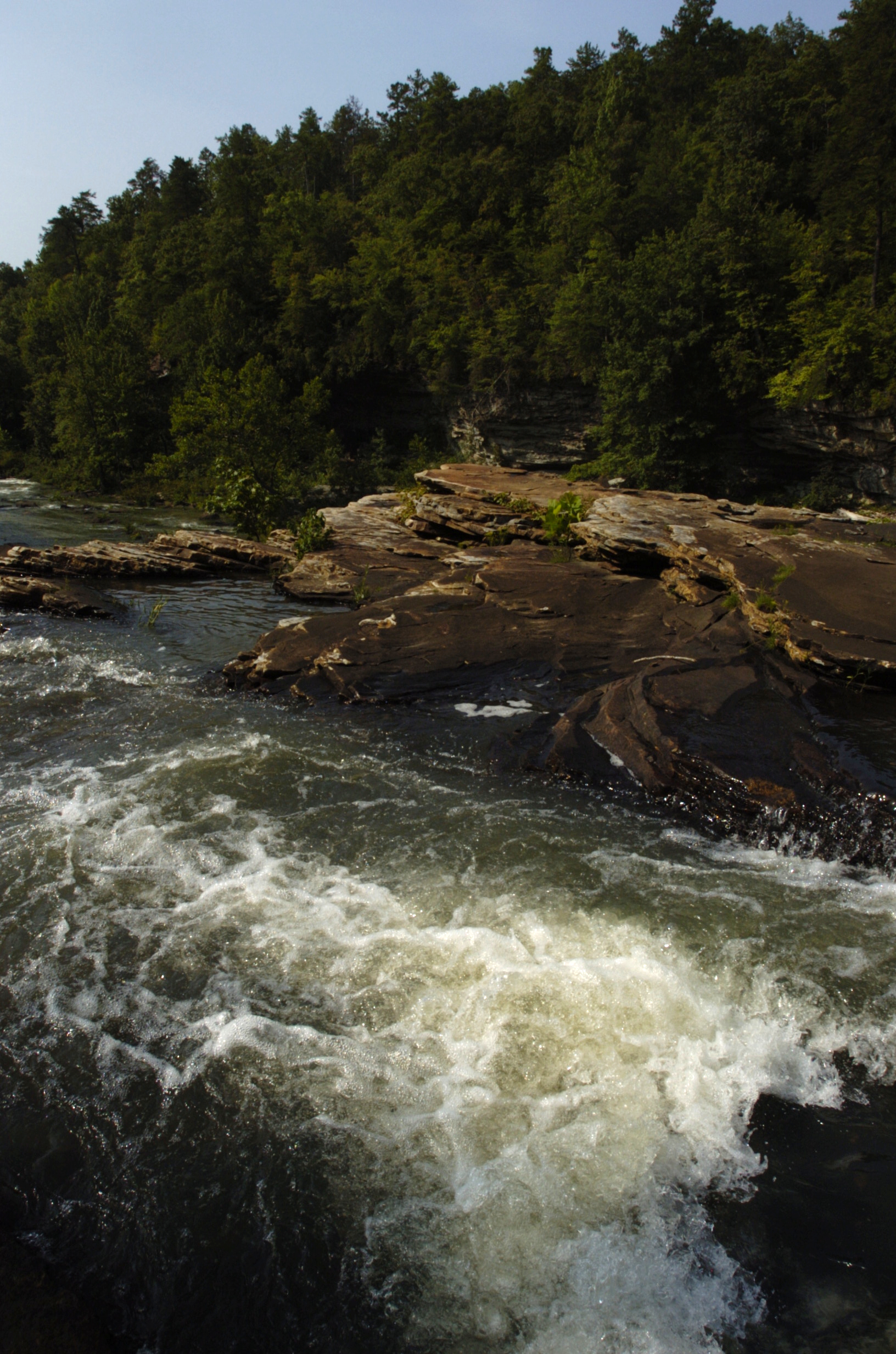 Staff file photo by Tracey Trumbull / Little Falls section of Little River Canyon National Preserve near Fort Payne, Ala., is seen in this file photo from 2011. Park officials say flash flooding on Easter Sunday 2020 caused the river channel to shift and damaged facilities. The area, atop Lookout Mountain, was created by Congressional Act in 1992 and boasts almost 14,000 acres of protected wilderness.